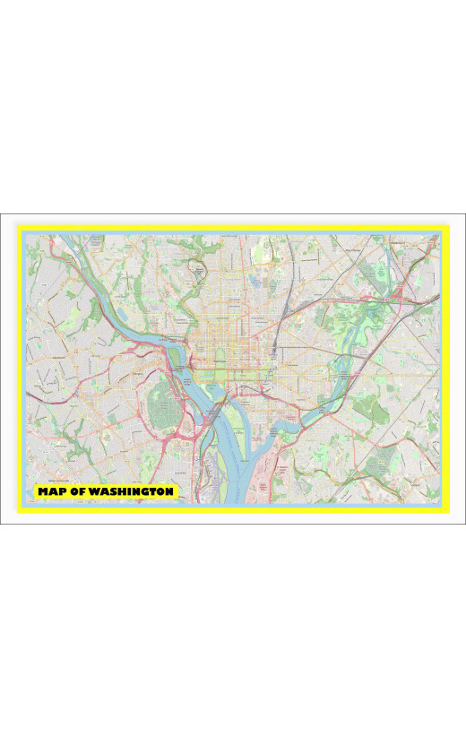
Our Map of Washington with Neighborhoods, Streets, Roads, Highways, and Parks - Laminated Wall Map Poster Print 2025 brings a new level of accuracy and detail to your walls. This poster incorporates the latest satellite imagery and geospatial data to provide a precise depiction of Washington state's geography. From the vibrant neighborhoods to the bustling streets, our Map of Washington 2025 captures the diverse terrain with unparalleled precision, making it an essential tool for navigation and exploration.
Continuously updated to reflect the ever-changing landscape of Washington state, our map ensures accuracy by integrating the latest information in real-time. This commitment to up-to-date data guarantees that the Map of Washington 2025 remains relevant, with updated roads, changes in land use, and evolving natural features. Stay current with the most recent infrastructure developments and landscape changes with our dynamically updated map.
One of the key features of our Map of Washington 2025 is its customizable layer functionality, allowing users to personalize their viewing experience. Whether you're interested in exploring neighborhoods, studying demographics, or tracking environmental changes, this map provides a comprehensive interactive experience. Advanced technology enables detailed customization, offering a tailored representation of Washington's geography according to individual preferences.
Designed for user convenience, the Map of Washington 2025 boasts an intuitive interface for easy navigation. Clear navigation tools, interactive search functions, zoom capabilities, and a user-friendly legend make this poster a breeze to use. The thoughtful design enhances the overall user experience, ensuring quick access to information and efficient exploration of Washington state's intricacies.
Our Map of Washington 2025 also pays homage to the state's cultural and historical landmarks with precise depictions. By including these significant sites, users gain insight into Washington's cultural heritage alongside its geographical features. Appreciate the state's history and context while navigating its streets and neighborhoods with this comprehensive map.
In conclusion, the Map of Washington with Neighborhoods, Streets, Roads, Highways, and Parks - Laminated Wall Map Poster Print 2025 offers accuracy, up-to-date information, and user-friendly design. With the latest geospatial technology and real-time updates, this map provides access to current and precise data. Enhance your exploration of Washington state with customizable layers and an intuitive interface, making this poster a must-have for anyone seeking an accurate and detailed map of Washington.
Available Options
Our Map of Washington with Neighborhoods, Streets, Roads, Highways, and Parks - Laminated Wall Map Poster Print 2025 brings a new level of accuracy and detail to your walls. This poster incorporates the latest satellite imagery and geospatial data to provide a precise depiction of Washington state's geography. From the vibrant neighborhoods to the bustling streets, our Map of Washington 2025 captures the diverse terrain with unparalleled precision, making it an essential tool for navigation and exploration.
Continuously updated to reflect the ever-changing landscape of Washington state, our map ensures accuracy by integrating the latest information in real-time. This commitment to up-to-date data guarantees that the Map of Washington 2025 remains relevant, with updated roads, changes in land use, and evolving natural features. Stay current with the most recent infrastructure developments and landscape changes with our dynamically updated map.
One of the key features of our Map of Washington 2025 is its customizable layer functionality, allowing users to personalize their viewing experience. Whether you're interested in exploring neighborhoods, studying demographics, or tracking environmental changes, this map provides a comprehensive interactive experience. Advanced technology enables detailed customization, offering a tailored representation of Washington's geography according to individual preferences.
Designed for user convenience, the Map of Washington 2025 boasts an intuitive interface for easy navigation. Clear navigation tools, interactive search functions, zoom capabilities, and a user-friendly legend make this poster a breeze to use. The thoughtful design enhances the overall user experience, ensuring quick access to information and efficient exploration of Washington state's intricacies.
Our Map of Washington 2025 also pays homage to the state's cultural and historical landmarks with precise depictions. By including these significant sites, users gain insight into Washington's cultural heritage alongside its geographical features. Appreciate the state's history and context while navigating its streets and neighborhoods with this comprehensive map.
In conclusion, the Map of Washington with Neighborhoods, Streets, Roads, Highways, and Parks - Laminated Wall Map Poster Print 2025 offers accuracy, up-to-date information, and user-friendly design. With the latest geospatial technology and real-time updates, this map provides access to current and precise data. Enhance your exploration of Washington state with customizable layers and an intuitive interface, making this poster a must-have for anyone seeking an accurate and detailed map of Washington.
